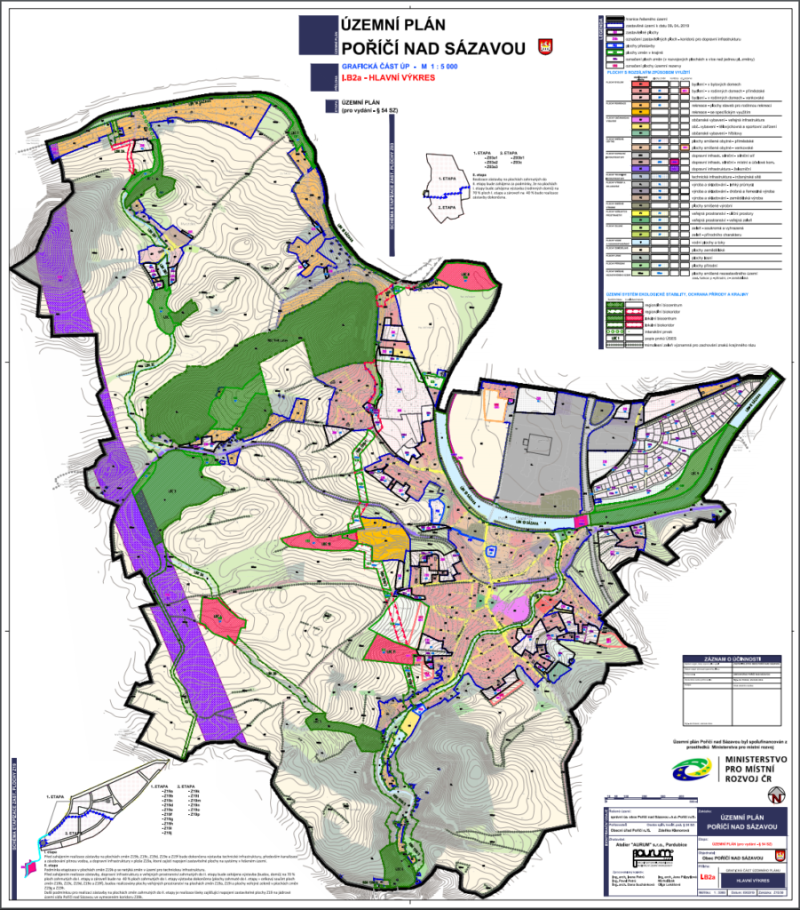
Spatial plan is one of the most important document for land buyers. In this article, we will explain:
- What spatial plan is
- Why it is important
- Where you find it
- How to use it
- Other spatial planning documentation (regulation plan)
What is spatial plan
Why it is important
As mentioned already above, spatial plan tells you how you can use your land or how the area around you can be used now or in the future.(e.g. new major road or future waste water plant facility). Spatial plan is a binding document, the Building Office must not issue a building permit, which would be in contradiction with spatial plan.
Spatial plan issue and amendment is subject to official procedures and as such they are usually matter of several months or years even. Several authorities have consultation rights to the spatial plan and can influence its content. Bear this in mind if you consider buying a land which usage is dependent on spatial plan amendment. It is always a risk and shall be reflected by lower price. You should also beware of impending spatial plan amendment that me adversely affect your selected land (in such cases, the seller would not inform you as likely as if the change is positive).
Where you find it
If you cannot find the spatial plan on none of the web pages, it is possible that the municipality might not have a spatial plan at all as it is not compulsory for a municipality to have it. If that is the case, you can build in the municipality’s urban area (area that is built over). You should consult with the municipality to verify the non-existence of spatial plan or to determine the built over area. Please note that municipalities without spatial plans are now rather rare in Central Bohemia, so we advise to search more thoroughly if you cannot find it.
How to use it
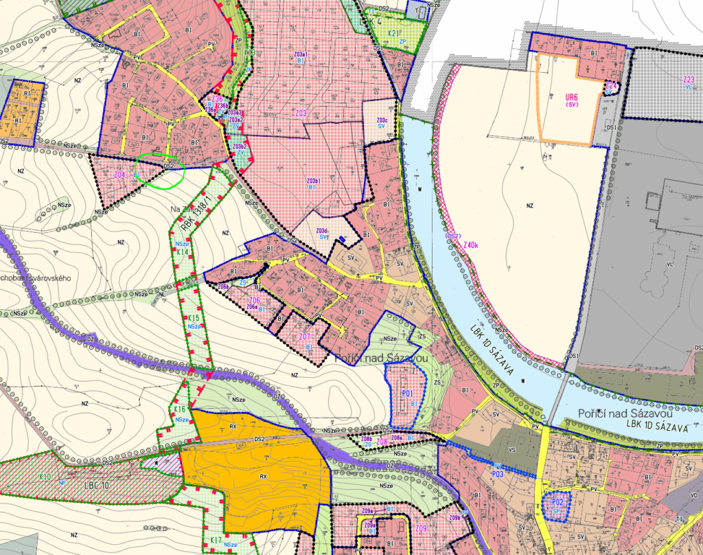
We explained in the introduction that spatial consists of text part and drawings. For land examination, verdict (výrok) and the main drawing (hlavní výkres) are essential. In the picture above, we see the main drawing of Porici nad Sazavou’s spatial plan. The municipality is not too big (around 1300 permanent inhabitants) and includes variety of area types. That is suitable for our demonstration.
So in our example, we found a nice land via an advertisement, the land is situated in Porici nad Sazavou. We know the street and we located the land in the map. Either in mapy.cz or in the land cadastre, we identified the plot number (see this article to find out how we did it).
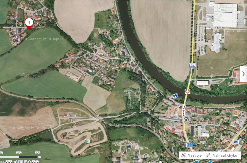
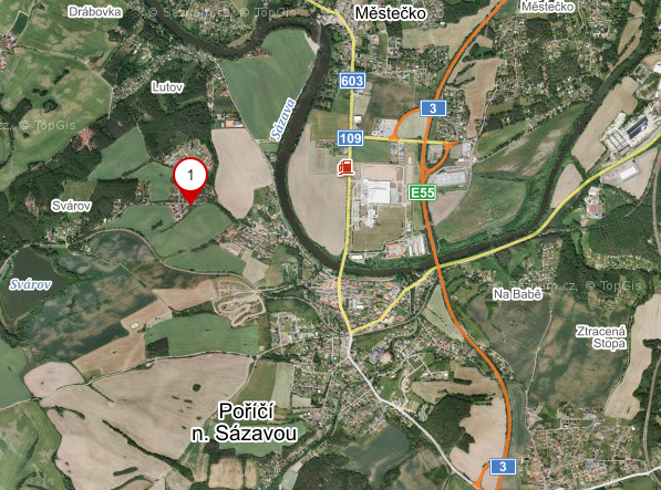
First step is to find out what type of land it is. This is specified in the main drawing in form of colour-coded area type. So we need to locate our plot in the main drawing.
For easier orientation in the main drawing map, determine a couple of landmarks that you can quite easily identify in the spatial plan drawing as well as normal map. In Porici nad Sazavou, the landmarks could be for example river (curved green line called Sazava), railway (there are two – the huge purple line on the left is the planned high velocity railway and then there is a smaller purple curved line in the middle that is the current railway), major road (grey line with dots on the right of the grey area) or cross arena (big orange area in the middle).
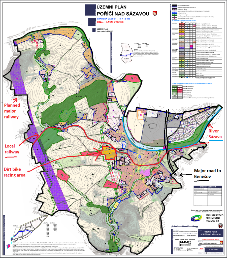
We could see in the map that our land is not far from the cross arena and from the railway. The land was located in the corner of a triangle of built over plots. Therefore, it is now not very difficult to find it in the spatial plan main drawing. We can also verify the plot number as it is written in this spatial plan (which is not a rule). You can also see that the area, in which our land is located, is labeled as Z04 and BI.
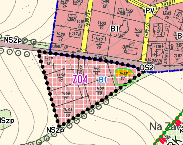
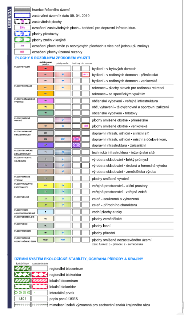
You can find out the meaning of Z04 and BI both in the main drawing’s legend and in the text part of the spatial plan. In the legend, you can see that BI is housing in family houses – urban type and that hatched area is a development area.
Before we go to the text part of spatial plan to find out what we can build on the plot, we want to draw your attention to other areas in the land proximity. We have already mentioned the cross arena, railway, major road and river. There is also an industrial zone (grey area). We talk about this more in the article Location – 10 Noise and pollution sources to watch out for. In our point of view, for our plot here, the biggest issue might be the cross arena and the railway. The major road is quite far and the river is quite below the plot (you can see the contour lines in the drawing or you can use mapy.cz turistic mode, we talked about this in the article How to use the Czech Cadastre of Real Estate when checking a land).
See also
- Location – 10 Noise and pollution sources to watch out for
- How to use the Czech Cadastre of Real estate when checking a land
